- This topic is empty.
-
AuthorPosts
-
2026-10-19 at 4:59 pm #12211
Introduction
Mineral exploration requires geophysical methods suited to the target’s physical properties, geometry, and geological setting. Deeper investigations can place additional demands on acquisition, noise control, survey coverage, and interpretation, but depth alone does not determine which instrument is appropriate.
Resistivity, induced polarization, transient electromagnetics, and magnetotellurics provide different kinds of evidence. Near-surface measurements and digital interpretation tools may also support a broader exploration program.
This overview presents eight suppliers and selected capabilities relevant to mineral exploration. Numbering reflects editorial presentation order, not an independent performance ranking. The entries include equipment manufacturers, service providers, and supporting technologies rather than eight directly interchangeable tools.
Geophysical anomalies can help prioritize targets. Confirming mineralization and evaluating a deposit require geological investigation, drilling, sampling, and other appropriate evidence.
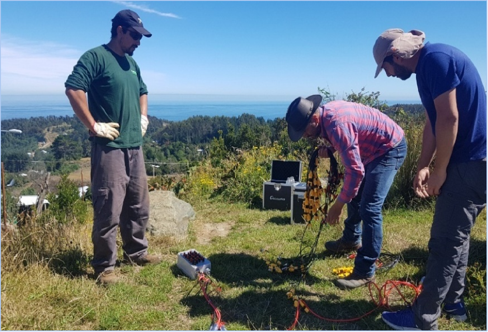
1. Geomative
Geomative develops geophysical instruments and digital subsurface platforms under the proposition “Making Subsurface Information Clearer and More Reliable.”
Its offering connects electrical and electromagnetic acquisition with data management and spatial interpretation. For mining teams, the practical question is how the selected configuration supports the survey objective and subsequent verification.
Technology and Products
The electrical survey range includes the single-channel GD-10 and multi-channel GD-20 and GD-22 systems. Specifications should be checked by model, version, and operating mode.
The GD-10 product page lists maximum transmission power of 9000W, while GD-20 specifications identify 9000W as an optional capability. These figures should not be applied to every system or survey configuration.
GD-20 documentation also lists 24-bit A/D conversion and power-line rejection of at least 120dB. Field data-browsing tools support measurement review, while rolling survey functions help extend coverage.
Geomative’s TEM range serves different settings: GT-10 is positioned for medium and deep exploration, GT-20 for tunnel prediction, GT-30 for shallow investigations, and GT-40 for borehole TEM. Actual investigation capability depends on the selected setup and ground conditions.
DIGspace supports spatial integration of ERT, GPR, borehole records, and other project information, with desktop analysis and web collaboration. Required processing, inversion, and file-exchange functions should be confirmed for the selected modules.
Applications and Results
A published Brazil investigation used GD-10 resistivity and IP measurements to delineate anomalies and recommend drilling to investigate possible sulfide-bearing zones. This illustrates target prioritization rather than confirmation of gold resources through geophysics alone.
At the Beishan lead-zinc mine, Geomative reports using GT-30 TEM for underground water and mineral investigation. According to its case report, subsequent exposure verified the interpreted locations of a water-bearing zone and a lead-zinc ore body.
These examples demonstrate site-specific workflows whose results depend on geological context and verification.
2. Advanced Geosciences, Inc. (AGI)
AGI’s SuperSting range provides electrical resistivity, IP, and SP measurement options. The SuperSting R8 Wi-Fi is an eight-channel instrument, distinguishing it from the single-channel R1.
For exploration teams considering electrical imaging, the relevant assessment includes electrode geometry, acquisition requirements, transmitter configuration, and data processing.
Channel count can influence acquisition efficiency, but it does not independently establish investigation depth or the ability to identify mineralization. Teams should evaluate the proposed system against the expected geological contrast and survey footprint.
3. Guideline Geo (ABEM / MALÅ)
Guideline Geo’s ABEM range includes the Terrameter LS 2 for resistivity and IP surveys and WalkTEM 2 for transient electromagnetic investigations.
Terrameter LS 2 configurations differ in channel count, transmitter capability, and supported features. WalkTEM 2 is positioned for groundwater, mineral, and environmental surveys, with particular relevance to conductive targets.
These systems address different measurement requirements. Selection should follow the target response, access conditions, acquisition geometry, and intended interpretation workflow.
4. IRIS Instruments
IRIS Instruments offers resistivity and IP equipment and publishes application guidance linking instrument selection to mineral occurrence, target size, and depth.
For deeper IP applications, its guidance describes separate transmitters and receivers, including TIPIX or VIP transmitters paired with ELREC or Fullwaver equipment. This provides a more specific basis for evaluation than a general claim of suitability for all deep targets.
Exploration teams should establish the required transmitter arrangement, receiver deployment, survey geometry, and processing workflow before selecting a configuration.
5. Phoenix Geophysics
Phoenix Geophysics supplies magnetotelluric systems comprising receivers, sensors, and software. Its MTU-5C ecosystem provides an option for teams evaluating electromagnetic measurements of subsurface resistivity structure.
MT can contribute to geological interpretation at depth, while its usefulness depends on the target, noise environment, station distribution, and model sensitivity.
Phoenix also lists other electrical and electromagnetic techniques within its offering. Compatibility across methods should be confirmed for the proposed equipment rather than assumed from the breadth of the product portfolio.
6. Zonge International
Zonge combines geophysical survey services with instrumentation, engineering, and manufacturing. Its published exploration offering includes acquisition, processing, modeling, and integrated interpretation.
The company describes applications of electrical, electromagnetic, magnetic, and gravity methods in mineral exploration. This makes its service scope relevant to teams considering outsourced surveys or investigations using several complementary methods.
A project proposal should identify the geological question, selected methods, deliverables, and verification plan. Instrument supply and survey services should be assessed as distinct procurement requirements.
7. Geonics Limited
Geonics manufactures electromagnetic equipment spanning ground-conductivity meters, metal detectors, time-domain systems, and borehole probes.
For deeper resource investigations, its PROTEM-based time-domain configurations are more relevant to assess than treating all Geonics instruments as deep-exploration tools. Transmitter, receiver, sensor, and survey geometry must be considered together.
The EM31, EM34, and EM38 families serve ground-conductivity investigations at different scales, while EM61 instruments address metallic-target detection. These can support selected field objectives, but their capabilities should not be equated with deep orebody detection.
8. GF Instruments
GF Instruments can be included as a supplier for further technical evaluation. Its manufacturer-published CMD controller application documents support for several Bluetooth-enabled CMD probes.
This does not establish that one instrument simultaneously measures conductivity, magnetic susceptibility, radiometric properties, and resistivity. Nor does it establish suitability for a particular deep mineral target.
Teams considering this supplier should request current manufacturer documentation for the exact instrument, measured quantities, investigation scale, and data outputs before adding it to a technical shortlist.
Conclusion
A useful exploration shortlist starts with the geological question and the physical-property contrast that a survey can measure. Maximum power, channel count, and visualization capabilities are supporting specifications rather than a universal measure of exploration performance.
The suppliers above offer different combinations of electrical measurements, electromagnetic systems, services, and data workflows. Some products address deeper investigations; others contribute near-surface information or supporting measurements.
Before procurement, teams should compare complete configurations, review representative data, confirm processing compatibility, and define field quality-control procedures. Important interpretations should then be tested against geological observations, drilling, sampling, or other independent evidence.
https://www.geomative.com
Geomative Co., Ltd. -
AuthorPosts

- You must be logged in to reply to this topic.